Over the years we have skied some of these lines many, many times and some of them are still waiting to be skied. Many combinations of uptracks have been tried and these are the ones that stand out as being the best. Not every uptrack and definitely not every ski line is appropriate on any given day. I thought about putting in typical avalanche start zones and rating the runs but for now you still have some decisions to make. These photos are also at the Lodge to inspect.
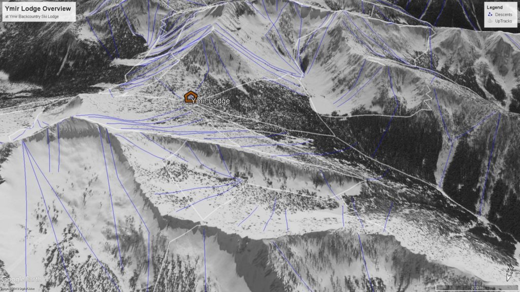
Ymir Lodge Overview ( From left – Long Qua below South Seeman Peak, Qua Delights at bottom right, Hidden Bowl, Qua Bowl, Baba Yaga ) In left background ( Wildhorse Peak, Clearwater Pass, Qua Peak ) 
Long Qua at top left, Hidden Bowl, Cook’s Apron on the South face of South Seeman Peak, Qua Peak North to right of Ymir Lodge and then Qua bowl. 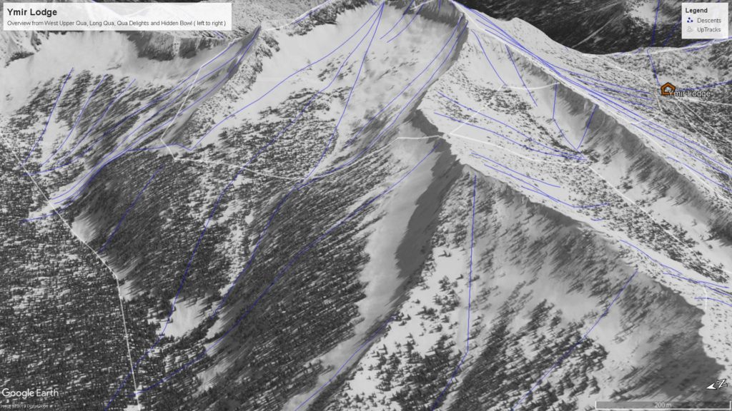
Upper Qua, Long Qua, Qua Delights, Hidden Bowl, Cooks Apron 
South Face of South Seeman Peak AKA Cooks Apron 
Hidden Bowl and Cook’s Apron 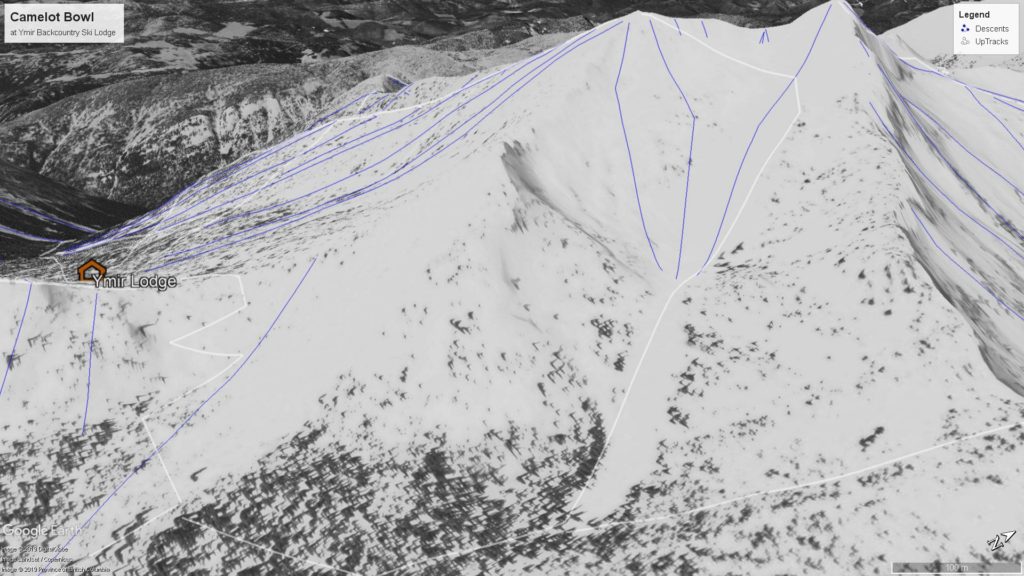
Qua Pass and Camelot Bowl 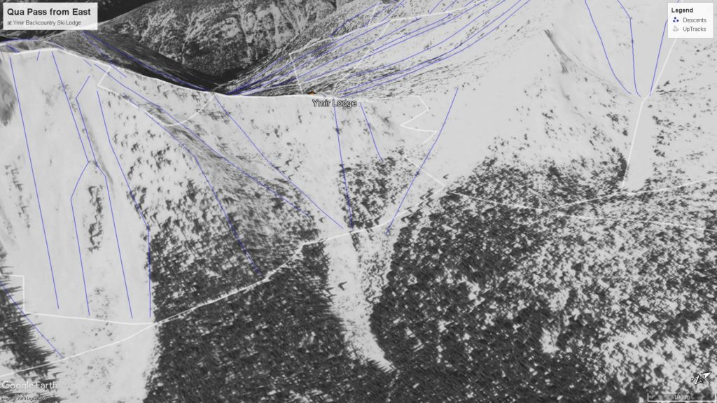
Morning Glory, Qua Pass Tree Triangle, Qua Pass, Camelot Bowl 
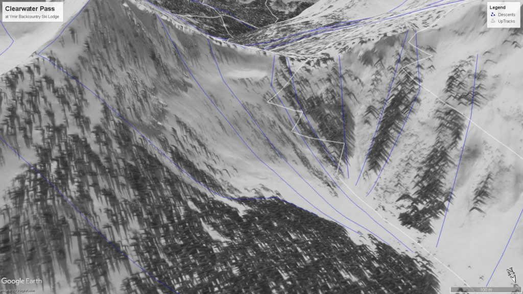
Mustang Face, Wildhorse Peak, Clearwater Pass 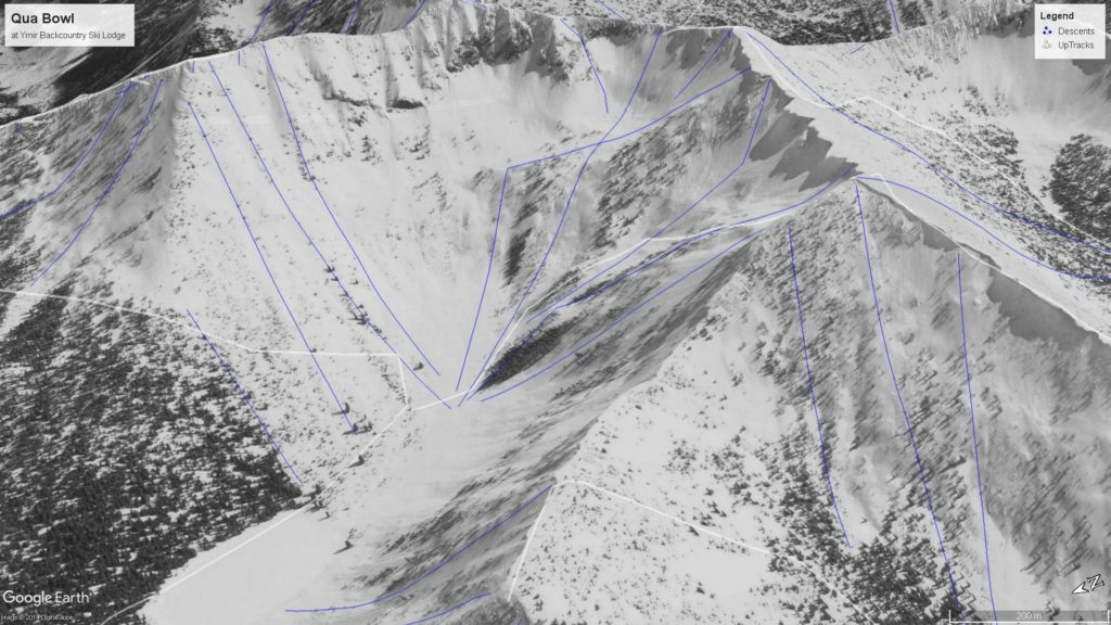
Qua Peak North with the Fine Line, Qua Peak, Qua Peak South with Clearwater Bowl at top and Baba Yaga at bottom right. 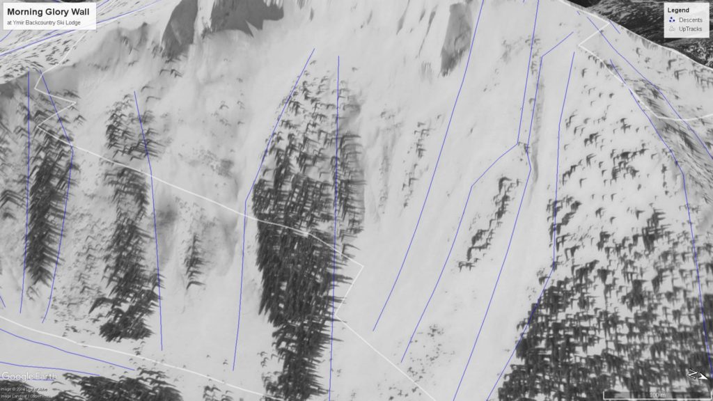
Morning Glory Wall below Qua Peak. Morning Glory Run is the slide path on right 
Long Qua 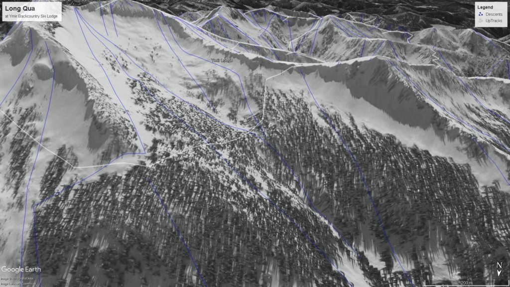
Long Qua 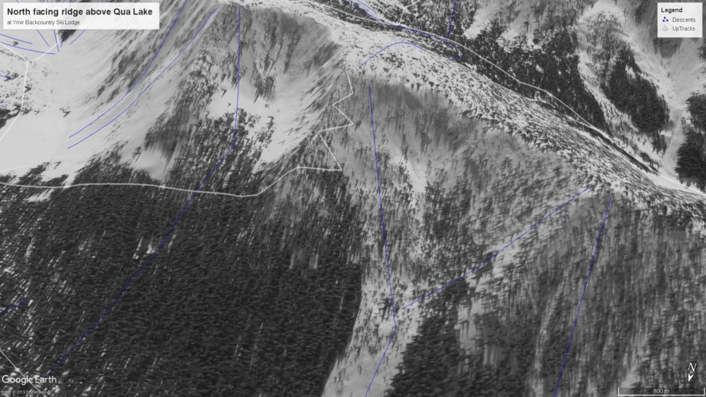
Baba Yaga ridge above Qua Lake 
Qua Bowl ( Qua Peak North, Qua Peak, Qua Peak South, Baba Yaga ) 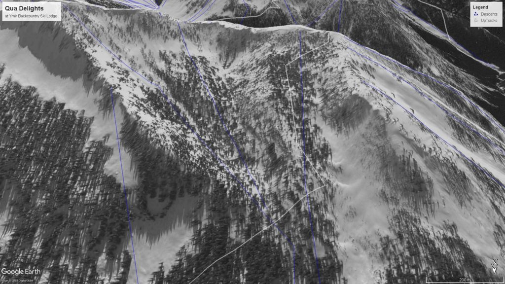
Qua Delights 
Qua Delights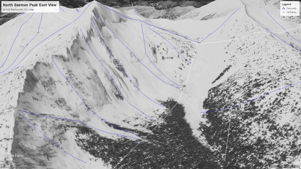
Camelot Bowl, North Seeman Bowl with Kututle Peak ( and Unbelievabowl on right ) 
North Seeman Peak from ridge on Kututle. Fantasy Forest is the treed bench and peak-a-boo Pass upper right. 
Kututle Bowl 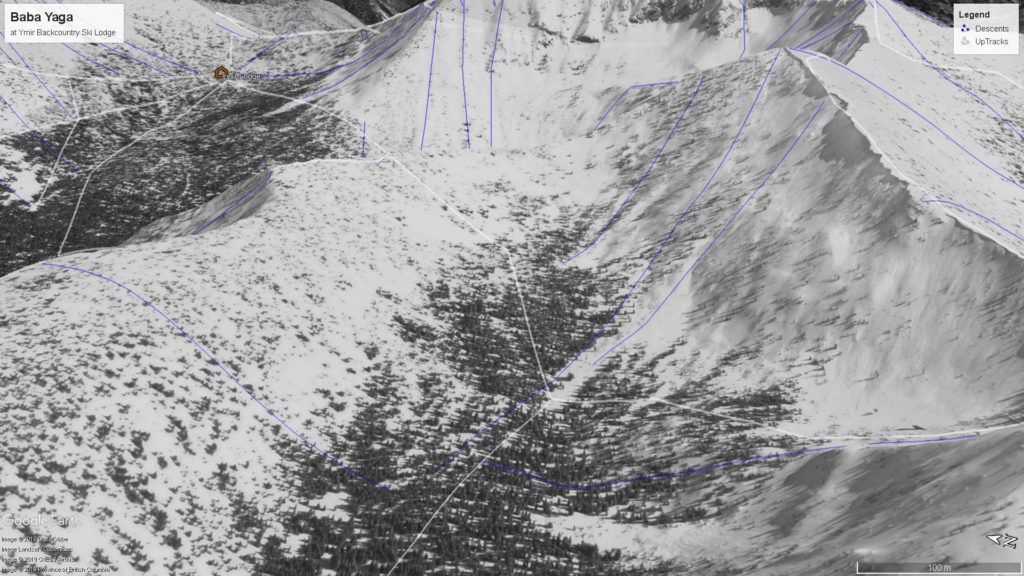
Baba Yaga 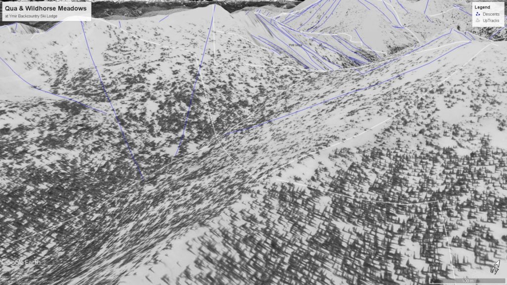
South Facing Meadows of Qua and Wildhorse Peaks 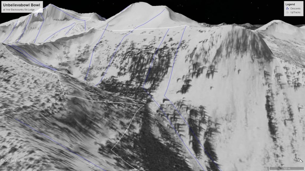
Unbelievabowl 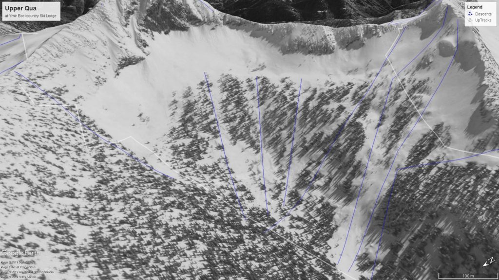
Upper Qua with Kututle on left and peak-a-boo Pass North Seeman Peak on right. 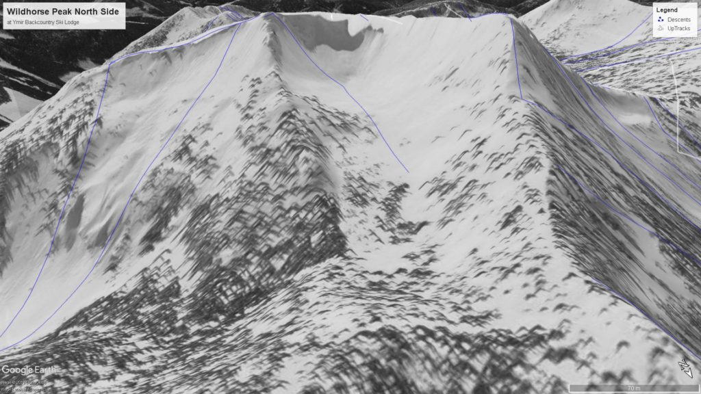
North Face of Wildhorse Peak 
Clearwater Bowl
Some basic weather information to consider. Our prevailing winds are from the South-West and are generally light. Locally the winds follow up Clearwater Creek and Qua Creek past the lodge through Qua Pass and kind of converge/cross load in that area. We seldom get a cold front but then the winds shift to the North. The temperatures are generally around -1C to -15C with almost half our snow falling in early winter so we get a good thick base fairly quickly without depth hoar problems. Our typical avalanche hazard is new snow instability / windslab and new snow loading or warming temperatures activating buried surface hoar.
December and January we would generally ski all aspects concentrating on south facing aspects for warmth, February we would ski south facing during storms and for a day or two after depending on crust development. March and April the crusts are thicker on the south facing slopes so need a foot in the storm to ski and we tend to look for the north facing lines and traverses.
Storm skiing zones.
- Start on the lower slopes of South Seeman Peak ( Cook’s Apron ). If temperatures are cold you can take these runs all the way to the creek below Qua Lake. For variety, you can also move around the corner to the most west, south facing slopes in Hidden bowl.
- The tree triangle on the east side of Qua Pass ( steeper and with some danger zones in the area ) and the home runs on the west side of Qua Pass.
- Trees on Wildhorse Peak north side. A little further to get there, steeper again with more danger in the area.
Longer Days with poor visibility
- Hidden Bowl. If stability is considerable do a run on cooks’ apron to start and wrap around the corner.
- Qua or Wildhorse Peak. The slopes on either side of Clearwater Pass are typically wind-loaded and quite often hide surface hoar pockets.
- Explore the bottom treed slopes of Qua bowl from Qua Lake or north facing runs below Qua Lake.
- Qua Delights.
Good Visibility and Moderate stability
- Camelot Bowl. Right from the summit, there is a small group of trees that allow easier access into the bowl.
- Long Qua. The hardest part is getting out either through Qua Delights or the steep wind-loaded pocket back into Hidden Bowl. The easiest line of entry is the obvious notch between North and South Seeman Peak. It is also the hardest to access.
- Wildhorse and Qua Peaks. Start by skiing Morning Glory and explore from there. Great skiing on all aspects.
Traverses
- Kututle. Ski Long Qua, Upper Qua into Kututle Bowl, Unbelivabowl, North Seeman Peak, Camelot and South Seeman Peak.
- Peak a Boo Pass. Shorter variation with some steep exposed skinning over the pass. Long Qua, Upper Qua, North Seeman drainage back to Qua Pass.
- Clearwater. Clearwater Pass, Baba Yaga, Qua Lake.
- There are lots of variations with loops and ways of connecting the tight terrain around the Ymir Lodge.
Big Lines
- Morning Glory
- Qua Bowl
- North Seeman. Lots of steep exposed options leading into Upper Qua or North Seeman Bowl.
Problem Areas
- Areas that are very close to the lodge that should be respected for their avalanche potential include: North facing zone right above lodge ( ridge leading up to Qua Peak North ), SW slopes around Fine Line ( Qua Peak North ), SE facing slopes to North of Qua Pass. Morning Glory area.
- Uptracks on the photos that are challenging windloaded pockets include upper exit from Hidden Bowl, exit from Long Qua to Hidden Bowl, Qua Bowl uptrack to Clearwater bowl, Baba Yaga uptrack to Clearwater bowl, and Peak a boo Pass from Upper Qua.
- There are lots of other zones that require caution as you push further from the lodge. Self-guided groups should have a rescue plan. British Columbia provides a backcountry rescue service called Provincial Emergency Service and is accessed through 911 or SPOT/In-Reach services.
Last Notes
- The names of the peaks in the area around the Ymir Lodge were not labelled on the 1:50,000 topo maps produced when we were first exploring this zone. As Google Earth started to become more detailed we realized that there were official names for some of these peaks. We have NOT changed our names. Our names of the peaks are referenced from the creeks that flow from that peak so it just makes sense. Many of the zones are named after these creeks, others were just made up because we had to.